









Just two years ago, Cao Bang barely featured in the itineraries of Western travellers. Since then, something has shifted. Social media began circulating images of Ban Gioc Falls, the first agencies started structuring tours, and travellers coming back from Ha Giang began asking themselves: “Did we miss something to the east?”
We know the answer well at Parfum d’Automne. Yes — they did miss something.
What is the Cao Bang Loop?
The Cao Bang Loop is a 350 to 400 km circular route in northeastern Vietnam, starting from the town of Cao Bang, running through the Non Nuoc Cao Bang UNESCO Geopark.
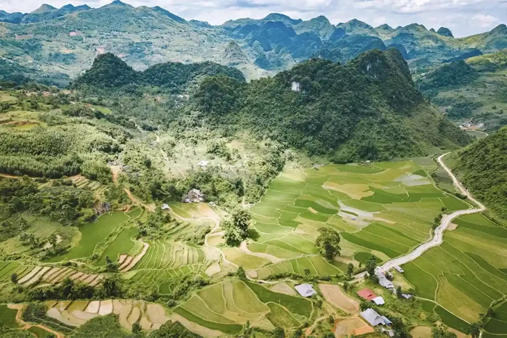
Cao Bang province sits in the extreme northeast of Vietnam, around 270 km from Hanoi and directly on the border with China. It is a region of karst mountains, deep valleys, dense forests and ethnic villages largely untouched by mass tourism.
The “loop” refers to a circular route that departs from and returns to Cao Bang town, crossing the province’s most spectacular sites. Unlike the Ha Giang Loop, which has become something of a two-wheeled tourist highway in recent years, the Cao Bang Loop remains a place where you can spend an entire day without crossing paths with another Western traveller.
In practice, the loop takes 3 to 4 days. It covers approximately 350 to 400 km depending on the variant chosen, and is organised around three main stages: Ban Gioc Falls and Nguom Ngao Cave in the north, Phuc Sen village and the Eye of God Mountain (Nui Thung) to the west, and the rice fields and stilt houses of the Nam Tra valley to the south.

Cao Bang or Ha Giang: which loop should you choose?
Ha Giang offers dramatic karst landscapes and an intense road-trip atmosphere; Cao Bang offers waterfalls, caves and isolated valleys in a more serene, less crowded setting.
This is the question we are asked most often by travellers planning their Northern Vietnam circuit. The honest answer: the two are different, and they are not mutually exclusive.
| Ha Giang Loop | Cao Bang Loop | |
|---|---|---|
| Dominant landscape | Arid karsts, dizzying mountain passes | Waterfalls, forests, rice fields |
| Tourist numbers | High (especially Oct–Nov) | Low to moderate |
| Riding/driving difficulty | High (narrow roads, steep grades) | Moderate |
| Recommended duration | 4 to 5 days | 3 to 4 days |
| Absolute highlight | Ma Pi Leng Pass | Ban Gioc Falls |
| Atmosphere | Intense, adventurous | Peaceful, otherworldly |
| Distance from Hanoi | ~300 km | ~270 km |
For travellers with 7 to 10 days available in Northern Vietnam, it is entirely possible to combine both loops. We design tailor-made circuits that link the passes of Ha Giang with the waterfalls of Cao Bang into a single, coherent loop from Hanoi.
For those with only 3 to 4 days, Cao Bang is a smart choice: it is more accessible, richer in varied natural discoveries, and offers that rare sensation of being genuinely off the beaten track.
What itinerary should you follow on the Cao Bang Loop?
The Cao Bang Loop is completed in 3 to 4 days from the town of the same name, with key stages including Ban Gioc Falls, Nguom Ngao Cave, Phuc Sen village and the Eye of God Mountain.
Here is the itinerary we recommend, tested and refined over our many trips through the region. It can be adapted to the pace and interests of each traveller.
Day 1 — From Cao Bang to Ban Gioc Falls
The day begins early from Cao Bang town. The road north follows the Bang Giang river before plunging into limestone gorges. The landscape changes gradually: valleys widen, karst peaks rise like sentinels, and Tày villages with their stilt houses pass one after another.
The first essential stop is Nguom Ngao Cave, just a few kilometres from the falls. It is one of the most impressive caves in Vietnam, with drapery-shaped rock formations and chambers stretching over more than 2.8 km. We always take the time to visit it properly — too many travellers treat it as a quick detour before Ban Gioc, when it easily deserves two hours of your time.
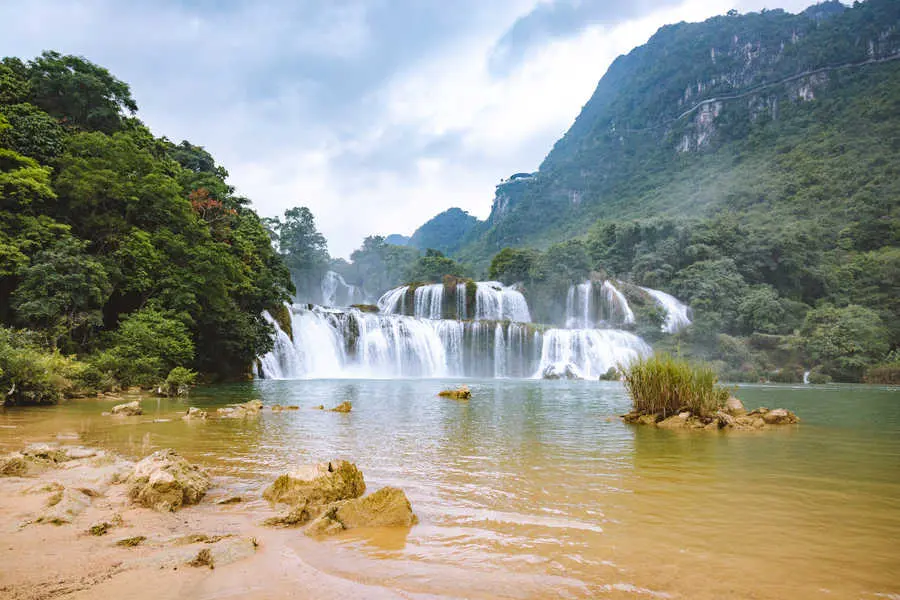
Ban Gioc Falls are best discovered in the late afternoon, when the light softens and the crowds of Chinese day-trippers (who arrive by bus in the morning) have thinned out. At 300 metres wide and spread across several tiers, Ban Gioc is officially Vietnam’s largest waterfall and one of the most spectacular in Southeast Asia. The border with China literally runs through the falls — a detail that takes nothing away from the beauty of the place, but gives it a particular atmosphere.
Overnight in a family-run homestay in the area, often hosted by Tày families.
Day 2 — Phuc Sen village and copper artisans
The second day takes a different direction: fewer dramatic landscapes, more human encounters. Phuc Sen village is one of the last villages in the province where Nung artisans still work copper by hand. Small family workshops produce utensils, vessels and tools — a craft passed down through generations for centuries.
The weekly Quay Son market, when the calendar allows, is one of the most authentic experiences in the region. Ethnic minorities come down from surrounding villages to stock up on supplies, and the atmosphere bears no resemblance to the heavily formatted “colourful markets” of Bac Ha or Dong Van.
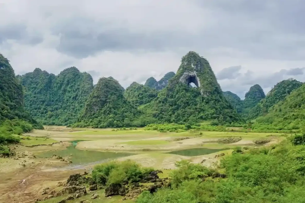
The afternoon can be devoted to the Eye of God Mountain — Nui Thung in Vietnamese, sometimes translated as Angel Eye Mountain in English. It is a karst formation pierced at its summit by a natural circular hole, visible from a distance like a giant oculus carved into the rock. The hike to the top takes around 45 minutes from the base and rewards you with a panoramic view over the surrounding valleys.
Day 3 — Return via the Nam Tra valley and Thang Hen Lake
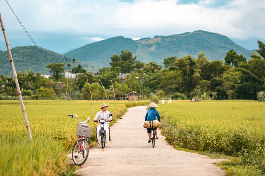
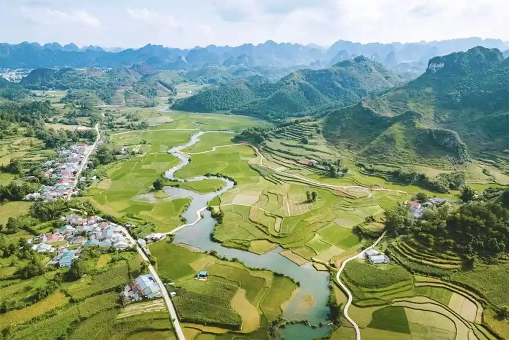
The third day closes the loop via the southwest. The Nam Tra valley is one of the least visited parts of the circuit: a succession of isolated villages, terraced rice fields and paths where water buffalo move peacefully along irrigation canals.
Thang Hen Lake is worth a stop: it is in fact a system of around thirty interconnected lakes whose water levels shift with the seasons. In spring, after the rains, they form an almost surreal scene of turquoise waters ringed by limestone cliffs.
The final stop before returning to Cao Bang is the Pac Bo site, linked to the history of modern Vietnam — this is where Ho Chi Minh is said to have hidden during the resistance. The site draws more Vietnamese visitors than foreigners, and it adds an interesting historical dimension to a circuit otherwise focused on landscapes.
What are the must-see sites on the loop?
Ban Gioc Falls, Nguom Ngao Cave, the Eye of God Mountain and Phuc Sen craft village are the four essential stages of the Cao Bang Loop.
Here are the sites that structure the circuit, with our on-the-ground perspective:
Ban Gioc Falls — The province’s most famous site, and one of the most beautiful in Vietnam. Best seen early morning or late afternoon to avoid the tour groups and enjoy the light. In September–October, the water flow is at its peak.
Nguom Ngao Cave — 2.8 km of galleries, exceptional limestone formations. Far less visited than the Phong Nha caves, it offers a more intimate experience.
Nui Thung (Eye of God Mountain) — A naturally perforated karst, visible from a great distance. The hike up is accessible, and the view from the top rewards the effort.
Phuc Sen village — The copper-working craft village, authentic and largely untouched by tourism. A rare stop to observe a living traditional skill.
Thang Hen Lake — A network of interconnected karst lakes, particularly spectacular between April and July.
Khuoi Ky village — A village of stone fortress-houses, typical of the Tày ethnic group. The buildings are centuries old and still inhabited.
Pac Bo site — A historic site linked to Ho Chi Minh, carrying strong symbolic weight for understanding 20th-century Vietnamese history.
What is the best time to do the Cao Bang Loop?
The best time to visit Cao Bang runs from October to April, when the weather is dry and the landscapes clear, with a peak of beauty in September–October when the falls are at their fullest.
Cao Bang’s climate is shaped by altitude (the town itself sits at around 300m, but the loop climbs well beyond that) and by its proximity to the Chinese border. The seasons are clearly marked.
| Period | Weather | Landscapes | Our view |
|---|---|---|---|
| October – November | Dry, cool mornings | Falls at high flow | Ideal |
| December – February | Dry, sometimes cold (5–10°C / 41–50°F at altitude) | Clear skies, morning mist | Very good, bring a warm layer |
| March – April | Warming up, occasional rain | Green landscapes, plum blossom | Good |
| May – August | Rainy season, landslide risk | Intense greenery, powerful waterfalls | Not recommended |
| September | Transition, occasional rain | Ban Gioc at maximum flow | Interesting for the falls |
One often-overlooked point: Cao Bang is very popular with Vietnamese and Chinese domestic tourists during public holidays and school breaks. Tet (January–February), Vietnam’s National Day (2 September) and the Chinese Golden Week (early October) can make certain sites crowded. We recommend avoiding these windows and favouring weekdays.
How do you organise a trip on the Cao Bang Loop?
The Cao Bang Loop is reached from Hanoi by overnight bus or private car, and is best explored with an English-speaking guide to access the most remote sites and authentic homestays.
Here is the essential practical information for planning your stay:
Getting to Cao Bang from Hanoi
Cao Bang town is around 270 km from Hanoi. Several options are available:
Overnight bus from Hanoi — Buses depart every evening from Gia Lam or My Dinh bus stations. The journey takes 6 to 7 hours. The most economical option.
Private car with driver — We organise comfortable private transfers from Hanoi, with the option of one or two stops along the way (notably in That Khe or Dong Khe, two little-known towns with a compelling history).
Combination with Ha Giang — For a larger Northern Vietnam circuit, we often connect to Cao Bang directly from Ha Giang, avoiding a return trip to Hanoi and considerably enriching the itinerary.
Getting around the loop
The Cao Bang Loop can be tackled in several ways depending on your profile and experience:
Motorbike (for experienced riders) — The most immersive way to explore the region. The roads are generally better than in Ha Giang, but some sections remain demanding. You absolutely need experience riding on mountain roads and a valid international driving permit.
Private car with driver-guide — Our recommendation for families, couples and anyone who wants to fully enjoy the landscapes without worrying about driving. The car also allows you to bring more luggage and reach more remote villages.
Guided group tour — A few local agencies offer group tours of 5 to 8 people, generally by motorbike. More affordable, but less flexible.
At Parfum d’Automne, we often integrate Cao Bang into our Northern Vietnam circuits, with an English-speaking guide who knows the region from the inside — its shortcuts, its addresses, its stories. If you are considering discovering this region as part of an organised trip, we invite you to explore our Cao Bang travel guide and tours to find the format that matches your pace.