


Discover in this article all the answers to your questions about Ha Giang Province.
Why visit Ha Giang, and how to get there? When is the best time to go? Which destinations should you prioritize? Where to stay?
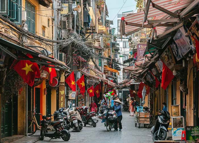
Still little known compared to Sapa, the province offers magnificent landscapes that will captivate travelers.
Contact us to organize your stay in Ha Giang.
Presentation of the Ha Giang region
Ha Giang is the name of the province located at the northernmost tip of Vietnam. It shares borders with four Vietnamese provinces (Cao Bang, Tuyen Quang, Lao Cai and Yen Bai) as well as China.
One of its most remarkable features is the Dong Van Karst Plateau, which covers more than 2,000 km² and extends across four districts of the province (Quan Ba, Yen Minh, Dong Van and Meo Vac). This plateau is the largest in Vietnam. Since 2010, it has been listed by UNESCO as part of the Global Geoparks Network (GGN), and offers breathtaking natural and untouched landscapes.
As you will see, Ha Giang is not limited to its limestone plateau — the region also boasts other equally impressive sceneries, such as terraced rice fields and dizzying mountain passes.
Long overlooked by tourism, the region is gradually opening up to travelers who seek majestic natural landscapes and wish to meet ethnic minorities with ancestral cultures. Its winding roads and raw beauty make Ha Giang a perfect destination for an authentic and adventurous journey.
Where is Ha Giang Province located?
Here is the region on the map of northern Vietnam.
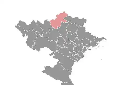
Ha Giang map, Vietnam
Why and how to visit Ha Giang Province? What to do there?
In this section, we’ll explain in more detail why we recommend visiting Ha Giang Province. We’ll then tell you how to get there and the best ways to explore the region once on site.
Let’s start with the main reasons why we think a visit to this province is worth it.
We see three key reasons:
#1. Meet the ethnic minorities of Northern Vietnam
#2. Discover breathtaking landscapes
#3. Travel through a preserved and little-known region
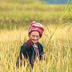
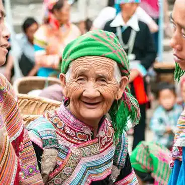
Meet the ethnic groups of Northern Vietnam
The region’s total population does not exceed 800,000 inhabitants, yet it is home to a remarkable diversity of ethnic groups — 17 in total have been recorded. The largest communities are the Hmong (around 35% of the population), followed by the Tay (25%) and the Dao (15%). The Kinh (or Viet) people represent only about 13%. However, with the growing development of tourism in the province, this proportion is likely to increase in the coming years.
This ethnographic configuration has changed over the centuries. From the 15th to the 17th century, the region was mainly inhabited by the Thai people, before being ceded to China and later returned to Vietnam at the end of the 18th century.
Today, it is primarily Hmong culture that is highlighted by local authorities to promote the province. Every year, a celebration is held in Dong Van in honor of Hmong arts and traditions.
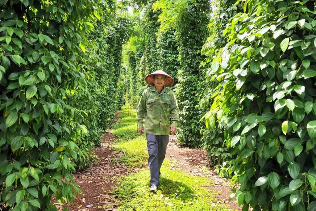
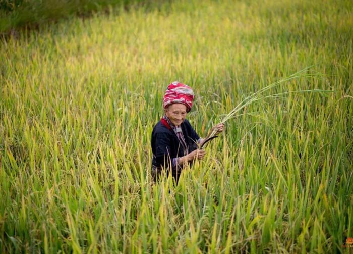
The ethnic communities of this region are remarkable for their ability to adapt to extremely harsh environments. Many continue to live on the Dong Van Plateau, maintaining their ancestral traditions for centuries — cultivating rice and corn on mountain slopes and raising livestock — shaping the landscape through their perseverance and labor.
Woman from Dao ethnic group, Hoang Su Phi, Ha Giang. Photo: Mathieu Arnaudet
Discover breathtaking landscapes
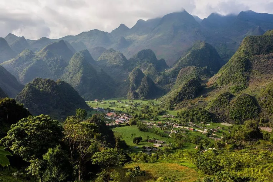
Every traveler returning from Ha Giang describes being deeply impressed by the scenery encountered along the journey. Although the region’s altitude is relatively modest (Dong Van at 1,500 meters and the Ma Pi Leng Pass at 1,200 meters), its mountain landscapes are both unique and spectacular.
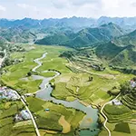
The variety of scenery is striking — rice terraces cover the Hoang Su Phi district in the southwest, while the limestone mountains dominate the Dong Van Plateau. Further inland, around Du Gia, lie fertile valleys dotted with villages and fields.
As you travel through the province, the landscapes change constantly, offering endless inspiration and delight for photographers.
Mountain road through the Dong Van Karst Plateau in Ha Giang, Vietnam. Photo: Mathieu Arnaudet
Travel through a preserved and little-known region
Unlike Sapa, which has experienced a massive influx of both foreign and Vietnamese tourists in recent years — to the point of altering the town itself — Ha Giang remains largely untouched by mass tourism. Its charm does not lie in relaxation or leisure but in discovery and adventure. Exploring Ha Giang Province requires effort, and that’s precisely what makes it so rewarding.
That said, the famous “Ha Giang Loop” has become increasingly popular among young travelers eager to tackle the province’s winding mountain roads by motorbike. Along the way, you’ll meet many of these adventurers. However, few take the time to venture into the villages and connect with local communities.
That’s what makes our tours truly special — accompanied by a professional guide and often a local escort, you’ll explore places where few travelers ever go. In many areas, you’ll genuinely feel like you’ve entered uncharted territory.
Moreover, the Dong Van Geopark is now recognized by UNESCO for its exceptional geological and mineral wealth, which compels local authorities to protect and preserve this unique environment. The initiative also includes a social and economic development program to support the local ethnic communities.
How to travel to Ha Giang Province
There are two main ways to reach Ha Giang:
1 – The most comfortable option is to include the drive from Hanoi as part of your travel itinerary. We can organize stops along the way to make the journey more pleasant and less tiring.
2 – The more economical, but also more tiring option is to take a day or night bus (sleeper bus) from Hanoi to Ha Giang City. The trip takes about 7 hours, and for roughly 10 euros, you’ll arrive in the provincial capital.
The Ha Giang Loop: exploring Ha Giang by motorbike or car
Sur pOnce there, a car or motorbike is essential to complete the famous Ha Giang Loop.
Here is the itinerary:
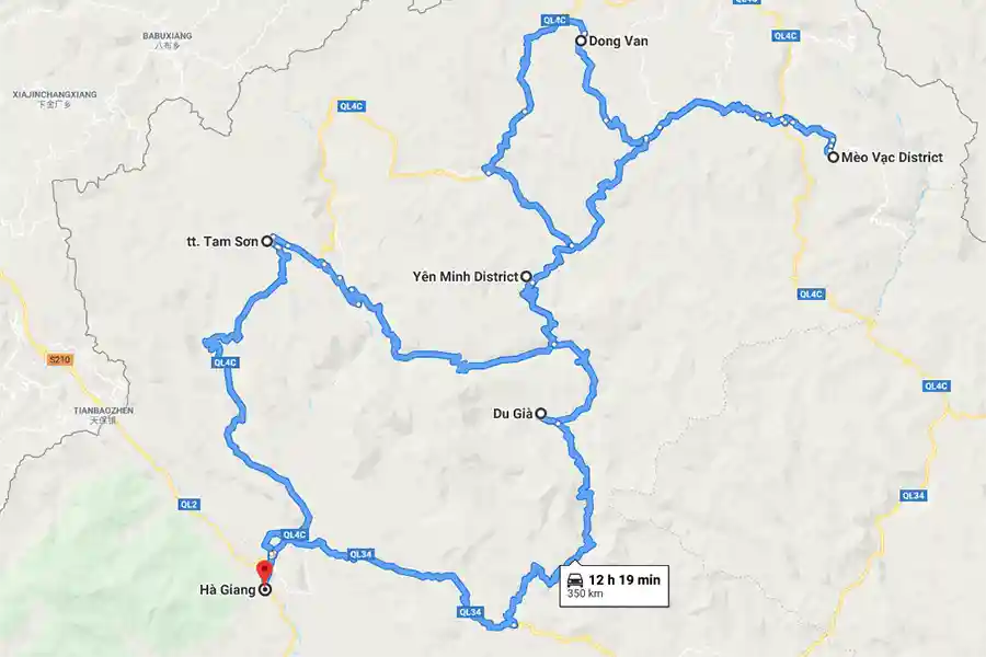
The Ha Giang loop on the map, Vietnam
This itinerary will take you through all the must-see destinations: the Quan Ba and Ma Pi Leng passes, the Dong Van Karst Plateau, and the traditional villages of Lung Tam and Du Gia.
The loop covers about 350 km of winding mountain roads. We recommend spending at least four days completing the circuit, as the distances may seem short but the curves and steep terrain make the journey longer — and all the more rewarding.
Hiking and trekking: taking the time to explore villages and meet the locals
Along this route, it’s best to allow yourself time to rest and to explore the surroundings on foot. During our private tours, we offer hikes and treks either along the Ha Giang Loop — for example around Du Gia and Dong Van — or in the Hoang Su Phi district.
Hoang Su Phi is the ideal destination for nature walks and for meeting ethnic minority communities. To reach this district, you’ll need a car or motorbike. Once there, you can set off with your guide for several days of trekking, discovering majestic landscapes and welcoming local people living in remote mountain areas.
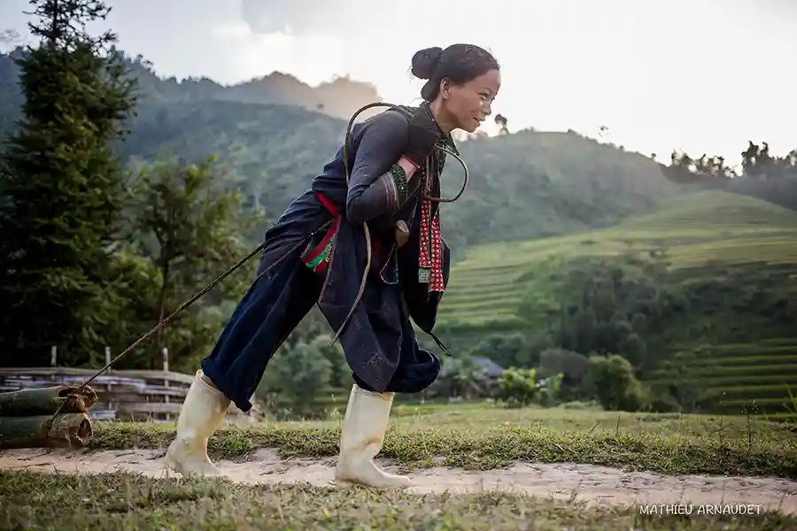
Woman pulling bamboo tree in Hoang Su Phi, Vietnam. Photo: Mathieu Arnaudet
Must-see destinations when traveling in Ha Giang
We’ve already mentioned them briefly — now let’s take a closer look at the places you shouldn’t miss during your stay in Ha Giang Province.
Nam Dam Village and the Quan Ba Pass
Nam Dam Village is often the first stop — or even the starting point — of the famous Ha Giang Loop. From Hanoi, you can choose to spend your first night in a local homestay in this village, located just 45 km from Ha Giang City. You’ll be welcomed by a Dao ethnic family who have opened their homes to travelers — your first authentic encounter with the region’s ethnic minorities.
Nam Dam lies in the Quan Ba District, known for its iconic “Fairy Mountains” rising from the valley. The view from the road is one of the most recognizable images of Ha Giang Province. Your guide will take you to the “Heaven’s Gate”, considered the entrance to the Dong Van Karst Plateau Geopark.
Upon arrival in Nam Dam, you can explore the surroundings with your guide, and even go hiking the next day — for example to the Kho My Cave, located about 25 km from the village.
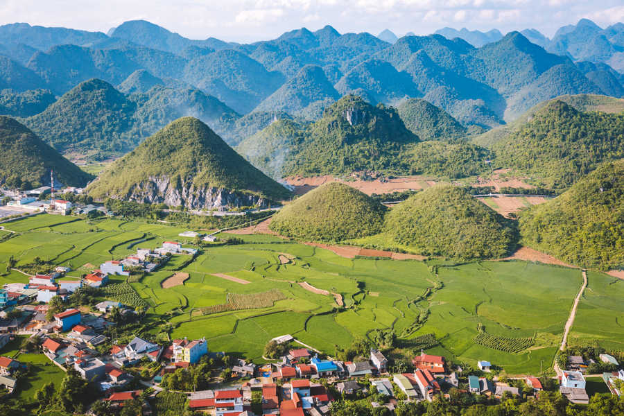
Quan Ba pass, Ha Giang, Vietnam. Photo: Mathieu Arnaudet
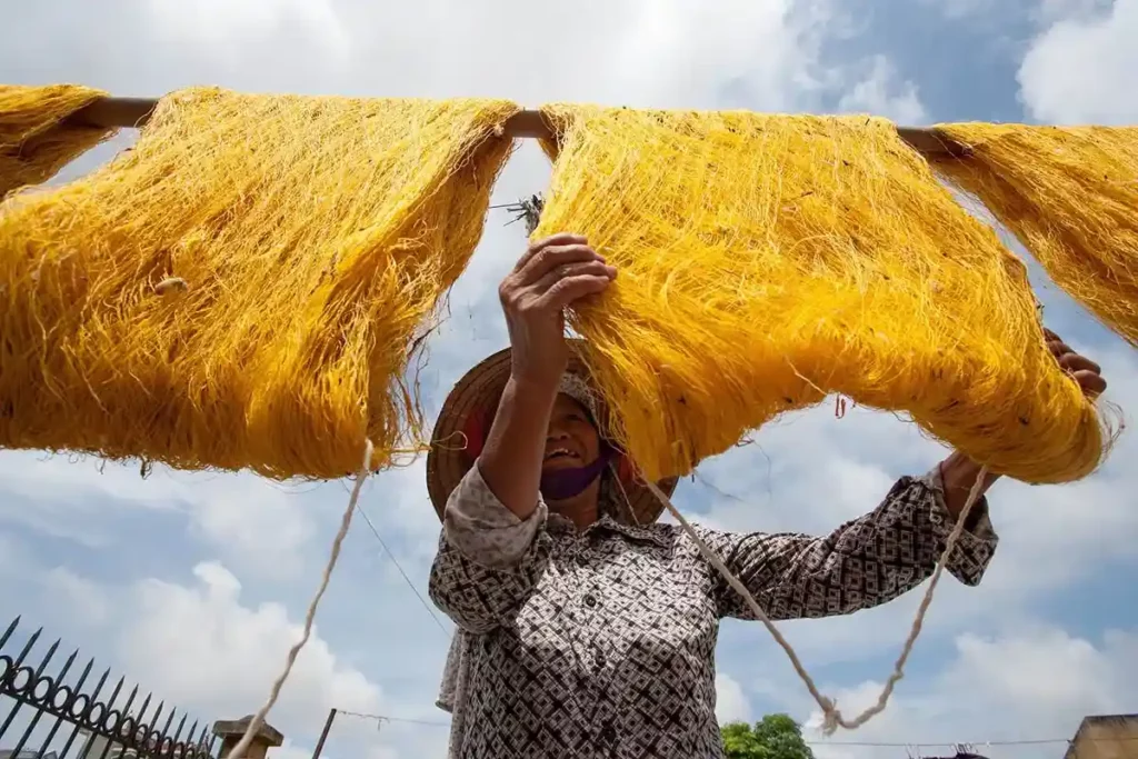
Lung Tam village
Lung Tam Village is located just 18 km from Nam Dam and is well known for its traditional weaving. You can visit a local cooperative established in 2001 to revive and promote the village’s ancestral handicrafts.
In 2009, the cooperative received financial and technical support from a French NGO called BATIK International. Thanks to this partnership, training programs were organized, creating new jobs and allowing the cooperative to modernize its equipment.
Don’t hesitate to stop by the cooperative’s shop to pick up a small, locally made souvenir!
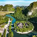
The Dong Van Karst Plateau
The geological park covers more than 2,000 square kilometers and spans four districts: Quan Ba, Yen Minh, Dong Van, and Meo Vac. Along the main road, you’ll see a succession of towering limestone peaks, each more striking than the last.
In recent years, researchers have discovered genuine geological relics here — including sedimentary formations and fossilized animals — which earned the park recognition as part of the UNESCO Global Geoparks Network. It is one of only two UNESCO-recognized geoparks in Vietnam, along with Non Nuoc Geopark in the neighboring province of Cao Bang.
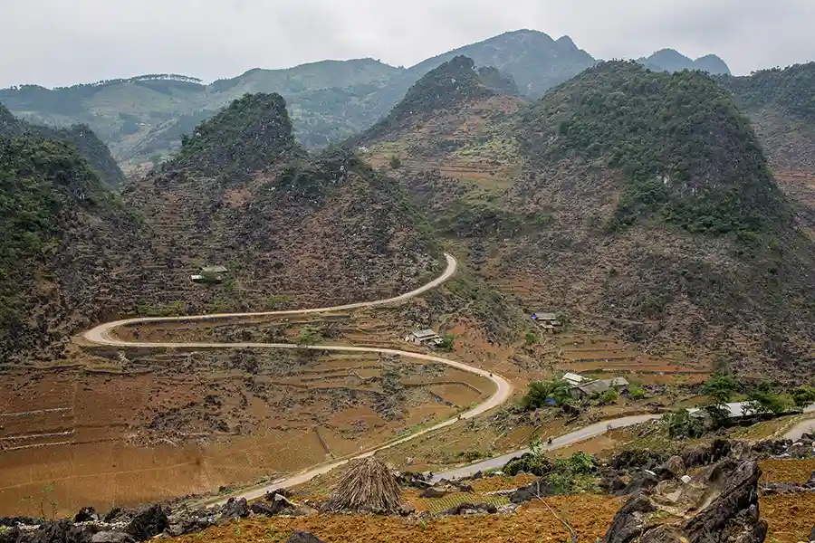
Road in Dong Van Karst Plateau Ha Giang. Photo: Mathieu Arnaudet
The Ma Pi Leng Pass
This mountain pass lies on the road between Dong Van and Meo Vac, known in Vietnamese as “Hanh Phuc Road”, meaning “The Road of Happiness.” Why “happiness”? Because when it was built in the 1960s, this road greatly improved the lives of the local people — before that, the two towns could only be connected by horseback. Interestingly, “Ma Pi Leng” literally means “the horse’s nose.”
Although not extremely high, the pass is famous for its breathtaking views. As the travel writer Olivier Page notes, “At the end of a narrow, winding road, one feels strangely as though standing at 4,000 meters.” From the summit, you’ll witness a masterpiece of nature — a landscape so vast and deep it’s almost humbling.
Below, the Tu San Canyon, carved by the Nho Que River, stretches into the distance. You’ll likely find yourself gazing at it in silence, feeling as though time itself has stopped.
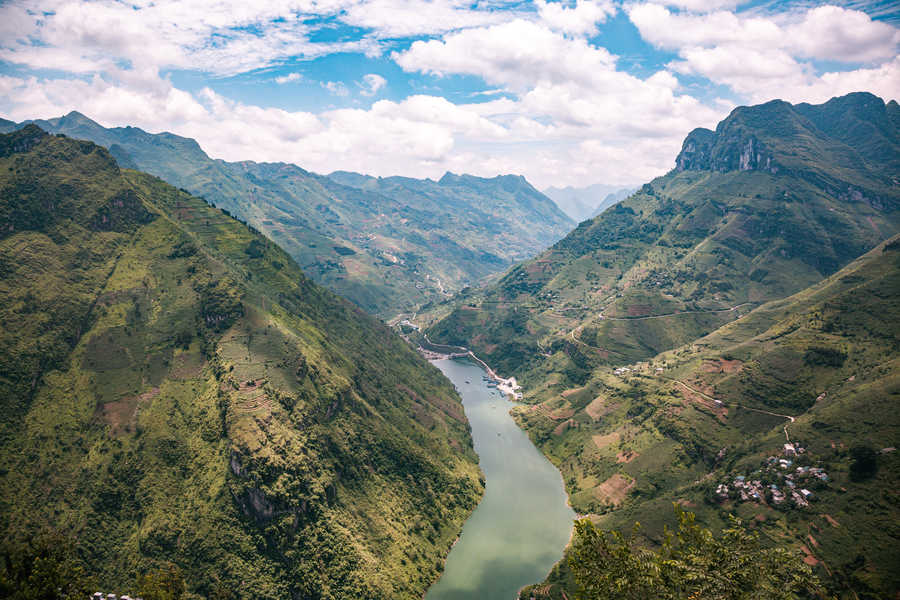
Ma Pi Leng pass, Ha Giang, Vietnam. Photo: Mathieu Arnaudet
Du Gia village
Du Gia is a small green paradise nestled in the heart of this limestone region. In 2015, the Vietnamese government designated the Du Gia Nature Reserve as a national park, in order to preserve the area’s unique natural resources (source: Courrier du Vietnam). The village of Du Gia is, in our opinion, the perfect starting point for hikes through the nature reserve.
Don’t miss the gathering of local ethnic minorities that takes place at the end of May — the village turns into a vibrant, colorful market, full of life and tradition!
Du Gia village, Ha Giang, Vietnam. Crédit photo: Mathieu Arnaudet
Hoang Su Phi District: the hidden terraced rice fields
Located in the western part of Ha Giang Province, Hoang Su Phi lies outside the main Ha Giang Loop, yet it’s a destination that, in our opinion, should be included in every trip to Vietnam.
This mountainous district is home to spectacular terraced rice fields. Just like in Sapa or Mu Cang Chai, the Dao people and other local communities have carved the mountainsides into breathtaking rice terraces — living works of art shaped by centuries of agricultural tradition.
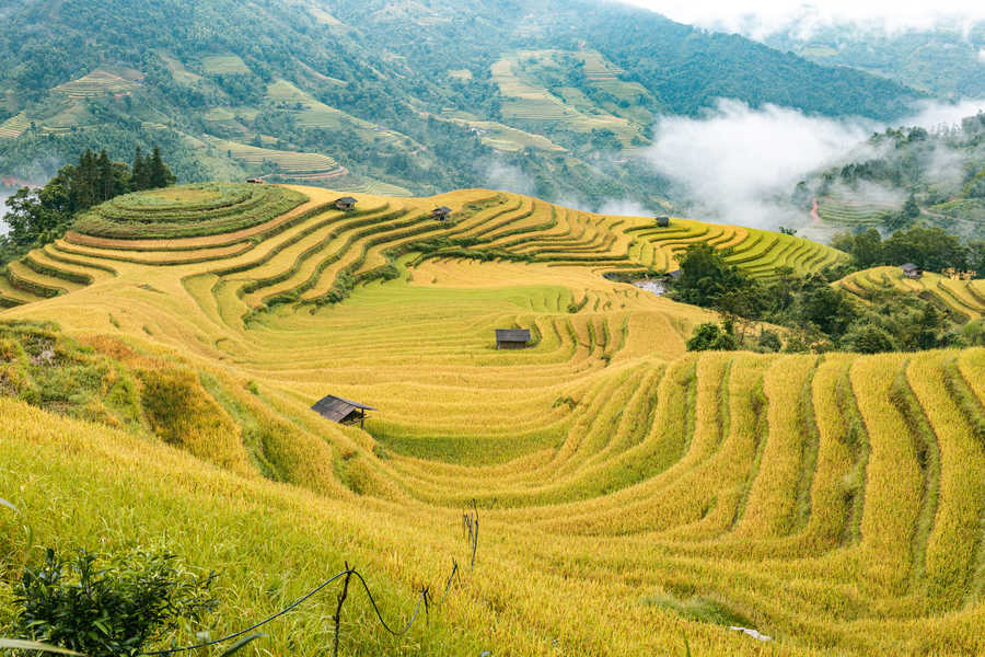
Landscape in Hoang Su Phi before harvest. Photo: Mathieu Arnaudet
It’s a stunning area, perfect for multi-day hikes. The district is home to several ethnic communities, and through our tour, you’ll have the opportunity to meet many of them.
As an off-the-beaten-path destination, Hoang Su Phi offers unforgettable moments of connection and exchange with the local people. That’s exactly what Vincent experienced last December during a six-day journey — which resulted in this moving video:
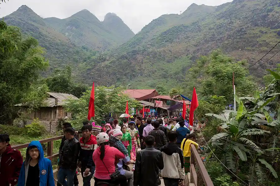
Festivals: a unique way to discover Ha Giang
Festivals are increasingly promoted in Vietnam as a way to highlight the distinctive cultures of each region. Ha Giang is no exception — the province hosts a number of fascinating festivals that give travelers an authentic glimpse into the traditions of its ethnic communities.
Each group has its own celebrations. For instance, the Pa Then ethnic group holds the famous “Fire Dance Festival” every year, starting in mid-October on the lunar calendar (around November–December in the solar calendar). The opening ceremony is spectacular — young men jump into the fire and dance barefoot in the flames without feeling pain, believed to be protected by the spirits that possess their bodies during the ritual.
The Lolo people, meanwhile, celebrate the “Praying for Rain” festival at the end of the dry season (around March in the solar calendar). Visiting the Lolo villages in the Meo Vac district at this time offers a rare opportunity to witness the animist traditions still deeply rooted in their culture.
Another major event is the Buckwheat Flower Festival. After the rice harvest, in October, the buckwheat flowers bloom for about a month, covering the hills in delicate shades of pink and purple. So, if you miss the rice harvest in Hoang Su Phi, don’t miss the buckwheat blossom season — it’s one of Ha Giang’s most beautiful sights.
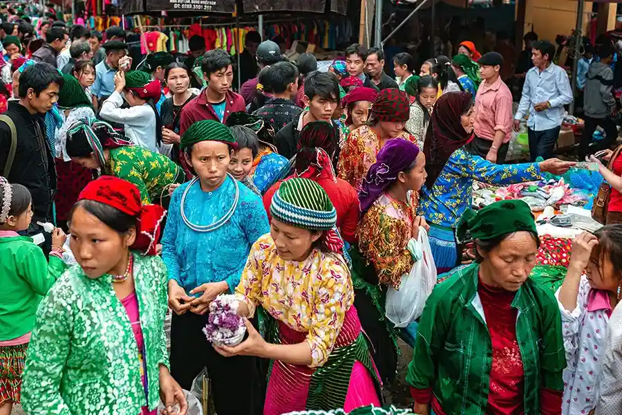
The markets of Ha Giang: at the heart of ethnic daily life
The markets of Northern Vietnam are held regularly and bring together local communities dressed in their traditional attire. Ha Giang Province is no exception, and we’ll be delighted to take you to at least one of these markets during your stay.
For example, you can visit the Lung Phin Market in the Meo Vac District, or the Hoang Su Phi Market, which takes place every Sunday. Near the Chinese border, you can also immerse yourself in the vibrant atmosphere of the Xin Man Market.
We’ll plan the dates of your journey in Ha Giang Province according to these markets — colorful and lively gatherings that offer a true insight into everyday life in the mountains of Northern Vietnam.
Market in Du Gia, Ha Giang, Vietnam. Photo: Mathieu Arnaudet
When to visit Ha Giang: the best seasons to go
Northern Vietnam truly experiences four distinct seasons. From December to March, you’ll need to pack warm clothes to explore this mountainous region located at the country’s northernmost tip.
The spring months (March to May) and autumn months (October to November) are the best times to travel the Ha Giang Loop — the weather is pleasant, temperatures are moderate, and you’ll avoid the heavy rains of summer (June to September).
However, to visit the Hoang Su Phi district, you should be prepared for a bit of rain — it’s the price to pay for witnessing its most breathtaking landscapes, between June and October. The rice harvest takes place in September, a magical time when families work together in the terraced fields — an unforgettable experience for travelers.
Where to stay in Ha Giang: a few great places
In Quan Ba, an association has been created bringing together several homestays in the villages of Nam Dam, Ngo Luong, and Pa Co. We have close partnerships with several families who will welcome you warmly! For a bit more comfort, we can suggest the Dao Lodge, built with the support of the Swiss NGO Caritas.
In Dong Van, you’ll find improved homestays offering more comfort, such as those run by the Bui family or the Dong Van B&B.
In Du Gia, the small village now has several homestay options, including the charming Du Gia Homestay, located slightly away from the main road for a quieter stay.
Finally, in Hoang Su Phi, we highly recommend spending a night at Panhou Village, which we consider the most beautiful ecolodge in Northern Vietnam. The property blends perfectly with its natural surroundings. A new ecolodge, the Hoang Su Phi Lodge, has also recently opened. During your treks, you’ll stay in local homestays for a truly immersive experience with the villagers.
Ha Giang or Sapa — do you have to choose?
Let’s end this article with a question many travelers ask: which should you choose — Ha Giang or Sapa?
Or rather, do you really have to choose?
Not necessarily! The landscapes of Sapa and the Ha Giang Loop are quite different, and it would be a shame to miss out on a trip that includes both destinations.
However, the question becomes more relevant if you’re deciding between Sapa and Hoang Su Phi. While the scenery may look similar, the warm welcome and authenticity you’ll experience in Hoang Su Phi will stay with you for a long time.
Hoang Su Phi is, without a doubt, our favorite destination in Northern Vietnam!