


Want to explore the Ha Giang Loop?
You’re absolutely right — these may be the most spectacular landscapes in Northern Vietnam.
It’s worth remembering that only ten years ago, a special permit was still required to visit this border region with its breathtaking scenery.
Today, that is no longer the case, and all travelers are warmly welcomed!
In this article, we describe the most beautiful stops that make the Ha Giang Loop an absolute must during your trip to Vietnam. And if we convince you to visit this stunning region, you might be tempted by our 5-day Ha Giang Loop tour, accompanied by a French-speaking guide, allowing you to go beyond the beauty of the landscapes and enjoy unforgettable encounters.
Ha Giang
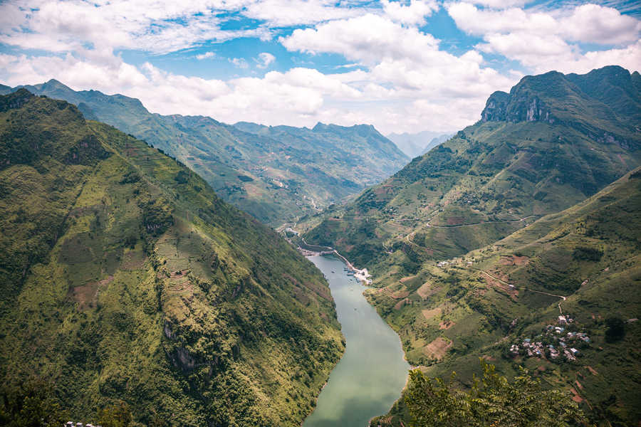
Ha Giang is the name of the province located at the northernmost tip of Vietnam. It shares its borders with four other Vietnamese provinces (Cao Bằng, Tuyên Quang, Lào Cai, and Yên Bái) as well as China.
The province’s main distinctive feature is the Dong Van Karst Plateau. Spanning more than 2,000 km² and covering four districts of the province (Quan Ba, Yên Minh, Đồng Văn, and Mèo Vạc), this plateau is the largest in Vietnam. Classified since 2010 as part of the UNESCO Global Geoparks Network (GGN), this area offers wild and fascinating natural landscapes.
Long overlooked by travelers, the region is now fully opening up to tourism, much to the delight of visitors seeking majestic natural scenery and hoping to meet ethnic groups with ancestral cultures. With its winding roads and raw landscapes, Ha Giang is an ideal destination for authentic and adventurous travel.
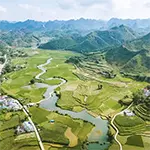
Ha Giang Province on the Map
Here are two maps. The first one, on the left, shows where Ha Giang Province is located in Northern Vietnam. The second, on the right, details the districts within the province itself. This will help you easily situate the province within Vietnam’s geography and then locate the destinations we will talk about.
The must-see stops on the Ha Giang Loop
We will now tell you more about the key stops you shouldn’t miss during your trip along the famous Ha Giang Loop.
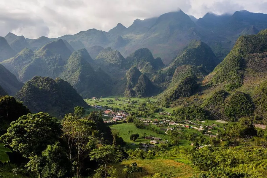
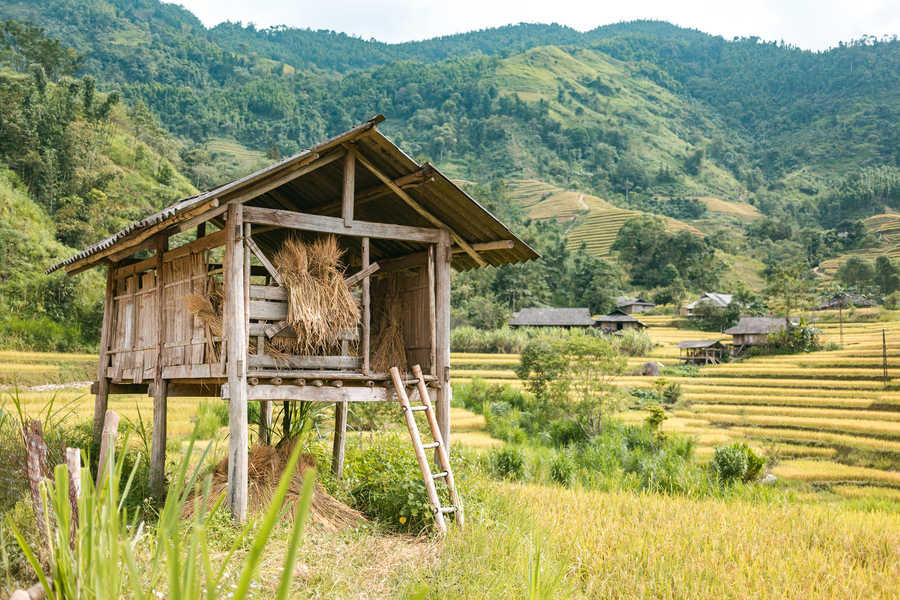
Nam Dam village and the Quan Ba pass
The village of Nam Dam is often the first stop, or even the starting point, of the Ha Giang Loop. From Hanoi, for example, you could choose to spend your first night in a local homestay in this village located just 45 km from Ha Giang City. You will be welcomed by one of the Dao ethnic families who open their homes to travelers. This will be your first encounter with the region’s ethnic minorities. This village lies in the Quan Ba district, known for its mountains (“Fairy Bosom Mountains”) rising above the valley. The view from the road is one of the iconic images of Ha Giang Province. You can also reach the “Heaven’s Gate”, which marks the entrance to the Dong Van Geological Park.
Upon your arrival in Nam Dam, you can explore the surroundings with your guide, and even go hiking the next day to reach sites such as the Kho My Cave, located 25 km from Nam Dam.
Lung Khuy cave
You will head north, pass through Ha Giang (where you can buy fuel, clothes, or even a small pharmacy kit). A winding road through impressive mountains leads you to Lung Khuy Cave. Inside the cave, you’ll find magnificent stalagmites and stalactites. It is easy to explore because a walking path has been built throughout. The entrance fee is 50,000 VND.
Lung Tam village
Just 20 km from your accommodation, on the road to Yen Minh, lies Lung Tam Village, known for its traditional weaving. You can visit a cooperative created in 2001 to revive and promote the village’s traditional handicrafts.
In 2009, the cooperative even received financial and technical support from a French NGO called BATIK International. Thanks to this partnership, the cooperative was able to organize training sessions and create jobs. Its equipment was also modernized.
So don’t hesitate to buy a small souvenir at the cooperative’s shop!
After visiting Lung Tam, you will continue toward Yên Minh, a small town where you can have lunch.
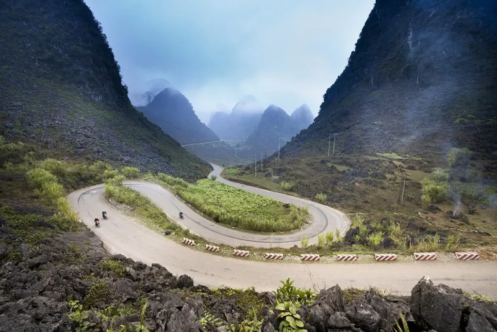
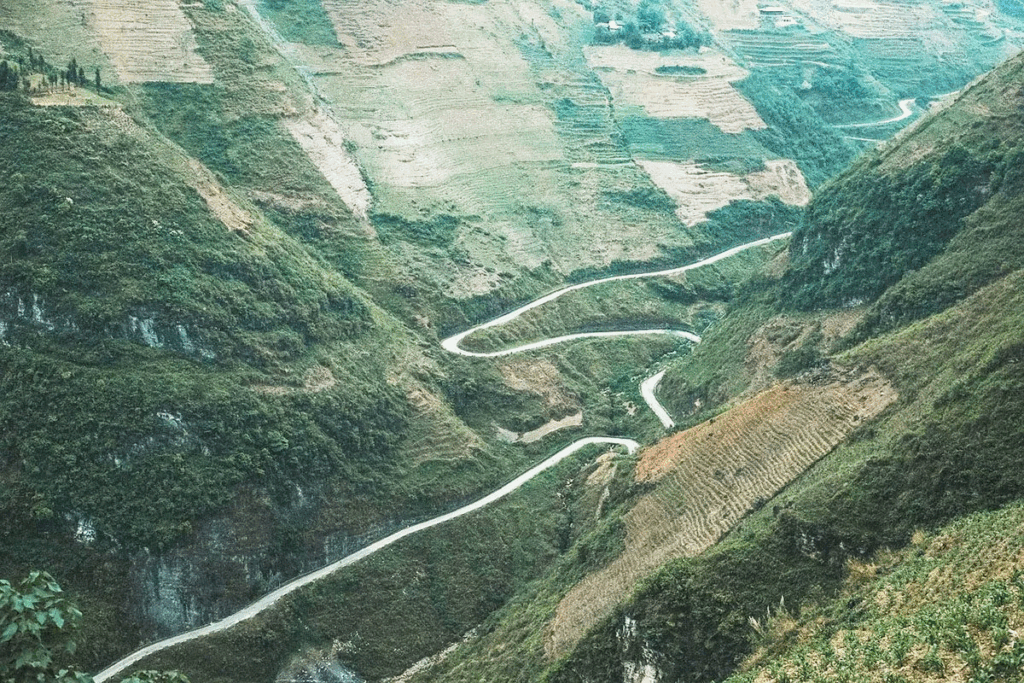
Tham Ma pass
The road from Yen Minh to Sa Phin will take you over Tham Ma Pass. This mountain pass is one of the most impressive in the Dong Van Karst Plateau Geopark. A winding road leads to a small parking area where you can take photos of the pass. Here is a photo of the winding road.
Sung La valley
Just before reaching Sa Phin, you’ll discover the beautiful Sung La Valley. This valley is known for being home to the most picturesque commune of the entire Dong Van Plateau. Especially during flower season, the landscape becomes spectacular and colorful. For this reason, it is also called the “Flower of the Plateau.”
In this valley lies Lung Cam Village, made famous by Pao’s House. This traditional Hmong house was used as the filming location for The Story of Pao, a movie known by all Vietnamese. You can visit the house to see what a traditional minority home looked like.
Some houses in the area open their doors and offer accommodation.
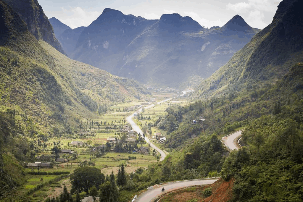
Sung La valley, Ha Giang. Photo : Pixabay
Sa Phin marché
After your night in the Sung La Valley, you will head toward Sa Phin, where a market bringing together the region’s ethnic groups is held. Be careful: the market takes place every 6 days, so you need to know the day of the previous market in order to plan your visit!
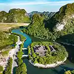
The Hmong king’s palace
After exploring the market, you can visit the famous Hmong king’s palace.
The Vuong Chinh Sinh Palace, also known as Vua Meo (King of the Hmong), was built in 1902 and served as the seat of power for two Hmong leaders. The Hmong people had dominated the region for centuries after migrating from southern China. The first of these leaders to live in the palace aligned himself with the French colonial authorities, while the second supported Ho Chi Minh’s struggle for independence.
The palace was turned into a tourist site in 1993 after being recognized as a national historical monument.
Built from wood and stone, the palace follows the layout of a traditional Chinese courtyard home, with four wings surrounding a central atrium. It is enclosed by an exterior stone wall, which once served as protection against attackers.
Legend has it that the king who built the palace first consulted a Chinese feng shui master to choose its location. The site in Sa Phin Valley was selected because the land resembled a turtle shell, an animal symbolizing longevity and wealth in local lore.
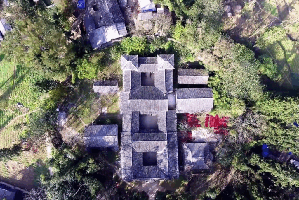
Hmong King’s Palace seen from above, Ha Giang
Lung Cu Flag Tower
Thirty kilometers from the Hmong King’s Palace, and after a winding road, you can climb to the top of the Lung Cu Flag Tower.
The giant flag marks the northernmost point of Vietnam. From the top of the hill, you can see both Vietnam and China. It is worth noting that the journey to Lung Cu and the surrounding area is one of the most remarkable highlights of the Ha Giang loop. Even if you are not particularly interested in the flag tower itself, the drive is still well worth it. You can also visit several local minority villages along the way. If you are tired after your day, you can spend the night in Lung Cu village.
Here is a list of homestays.
But you can also go directly to local households and ask if they have availability.
The old quarter of Dong Van
If you prefer to sleep in a hotel in town, you can continue to Dong Van from Lung Cu – it’s about a 1-hour drive. The historic part of the town is called the Old Quarter of Dong Van, featuring preserved architecture dating back several hundred years. Especially in the evening, it is very pleasant to sit here and enjoy the atmosphere. Behind the Old Quarter is an old French fort located on top of a mountain, offering a view over the town and the surrounding mountains.
Dong Van market
The advantage of sleeping in Dong Van is that you will already be on site to visit the town’s market. It is one of the largest in the province, and you might enjoy the festive atmosphere there. It is held every Sunday.
On the 14th, 15th, and 16th days of the lunar month, the market and the old town offer lively local cultural activities, such as bird-throwing competitions. They also showcase the traditional brocade-weaving techniques of the region’s ethnic groups.
Ma Pi Leng pass
After the market, head towards Meo Vac. Along the way, you will pass through Ma Pi Leng Pass, probably the most impressive section of the Ha Giang loop. This epic road is carved directly into the mountainside, with sheer cliffs dropping hundreds of meters. You can park your motorbike at the top to walk along a trail on the ridge and take stunning photos.
The famous Ma Pi Leng Pass. Photo: Mathieu Arnaudet
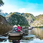
Nho Que river
At the top of Ma Pi Leng Pass, you can enjoy a spectacular view of the Nho Que River flowing between the mountains, deep inside the Tu San Canyon. There are also a few hidden roads that take you all the way down to the river. From there, you can take a boat trip: tickets cost 100,000 VND (4 euros) per person for a 30-minute ride. Visitors can request special stops to take photos along the canyon, known as one of the most magnificent in Southeast Asia.
At the top of Ma Pi Leng Pass, you can enjoy a spectacular view of the Nho Que River flowing between the mountains, deep inside the Tu San Canyon. There are also a few hidden roads that take you all the way down to the river. From there, you can take a boat trip: tickets cost 100,000 VND (4 euros) per person for a 30-minute ride. Visitors can request special stops to take photos along the canyon, known as one of the most magnificent in Southeast Asia.
Meo Vac and its market
Just about 10 kilometers from the Ma Pi Leng Pass lies the small town of Meo Vac.
If you are lucky enough to be in Meo Vac on a Sunday, you can wander through the market — one of the most traditional in all of Vietnam, no less. It starts very early in the morning and becomes less lively around 11:00 a.m. There is a section dedicated to livestock, where people bring their animals not only to sell them but also to show them. Outside, in the streets, many stalls sell all kinds of items, from local products to mobile phones. The indoor market is used as a large food market, offering fresh produce and small stalls where food is prepared over an open fire.
It is easy to find accommodation and spend the night here.
The spectacular road to Mau Due
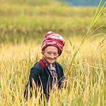
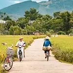
After the Sunday morning market, you can head towards Du Gia. The first part of the road, up to Mau Due, is exceptional and rivals the landscapes of the Ma Pi Leng Pass! Following zigzagging roads through the mountains, you will pass countless ethnic minority villages. You will see many ethnic people on the road and children waving at you as you ride by, all surrounded by impressive mountain scenery.
Spectacular road in Ha Giang. Photo credit: Pixabay/Phathuynhfuji
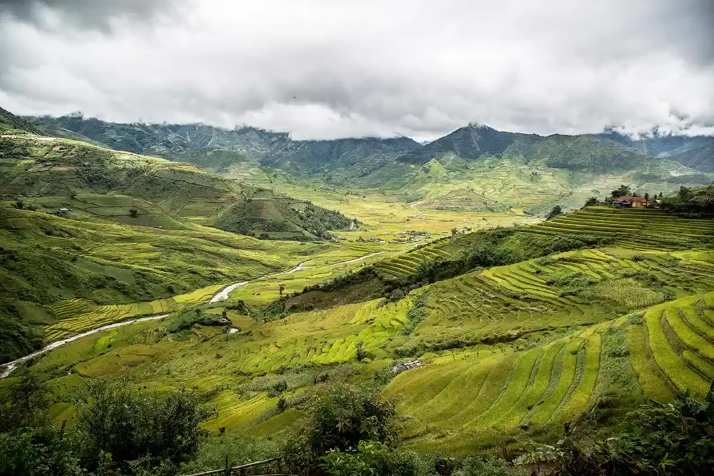
Mau Due valley
You will surely stop to admire the landscape once you arrive in Mau Due — it is truly magical. The valley is stunning and even features a few waterfalls that you can reach if you are traveling with a guide. However, exploring them will take around two hours.
Du Gia village
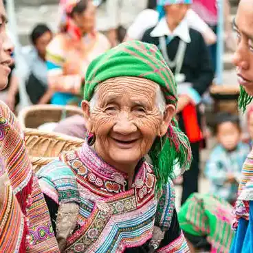
Here, you leave the Dong Van karst plateau and reconnect with the lush green landscapes typical of northern Vietnam — and it feels wonderful! We recommend spending the night here. Du Gia is one of the most picturesque villages in Ha Giang. What makes this place so special is its peaceful, unspoiled beauty, with majestic natural scenery of mountains and rice fields all around. Moreover, the local inhabitants are exceptionally welcoming and friendly.
Once a year (just once!), a major gathering of the region’s ethnic groups takes place at the end of May or early June. We were lucky enough to be there on that day. Look below at the village streets crowded with locals dressed in their finest traditional clothing.
We recommend organizing a full-day hike through your accommodation to enjoy the surroundings and take a break from the road for a while.
From Du Gia, you can reach Ha Giang in about 3 hours.
The itinerary we recommend
Day 1 (Wednesday): Departure from Hanoi and arrival in the village of Nam Dam (near Ha Giang) in the afternoon – overnight stay with a local family.
Day 2 (Thursday): Departure from Nam Dam to Sung La. Stops at Long Kuy cave and the village of Lung Tam. Overnight in the Sung La valley.
Day 3 (Friday): Travel towards Lung Cu. Stops at Sa Phin (you might be lucky to see the market) and the Hmong King’s Palace. Overnight in the vicinity of Lung Cu.
Day 4 (Saturday): Drive to Dong Van, with a possible stop for lunch. In the afternoon: drive to Meo Vac via the Ma Pi Leng Pass. Opportunity for a short boat ride on the Nho Que River. Arrival in Meo Vac at the end of the day.
Day 5 (Sunday): Breakfast at the Meo Vac market. Then drive to Du Gia, passing through the beautiful Mau Due valley. Overnight in Du Gia.
Day 6 (Monday): Hike around Du Gia. Second night in Du Gia.
Day 7 (Tuesday): Return to Ha Giang. You can take the bus back to Hanoi. If you are on a private tour, you can of course depart directly from Du Gia without returning to Ha Giang. Arrival will be either at the end of the day or the next morning in Hanoi.
If you truly want to take your time to enjoy the incredible landscapes of the region and meet local inhabitants, it is recommended to plan for about a week in the area.
Want to discover Ha Giang privately with a English-speaking guide?
Check out our 8-day tour to visit Ha Giang and Cao Bang.